Stoneham, Colorado
Stoneham, Colorado | |
|---|---|
 A view of Stoneham and Colorado State Highway 14. | |
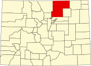
Location in Weld County and the state of Colorado | |
| Coordinates: 40°36′17″N 103°39′56″W / 40.60472°N 103.66556°W | |
| Country | |
| State | |
| County | Weld County[1] |
| Elevation | 4,583 ft (1,397 m) |
| Population (2020) | |
| • Total | 20 |
| Time zone | UTC-7 (MST) |
| • Summer (DST) | UTC-6 (MDT) |
| ZIP code[2] | 80754 |
| Area code | 970 |
| GNIS feature ID | 0182781 |
Stoneham is an unincorporated community and a U.S. Post Office located in Weld County, Colorado, United States. The Stoneham Post Office has the ZIP Code 80754,[2] and has been in operation since 1907.[3]
Stoneham is approximately 24 miles west of Sterling, 24 miles north of Brush, 43 miles south of Kimball, and 56 miles northeast of Greeley.
History
[edit]The Chicago, Burlington, and Quincy Railroad built a rail line from Holdrege to Cheyenne in 1887, passing through the future Stoneham.[4] Stoneham was established in 1888, although a drought strained the town's resources, and forced the closure of the post office from 1892 to 1907.
During the days of CB&Q passenger service, Stoneham was served by the 159 and 160 trains between Sterling and Cheyenne. By train in 1951, Stoneham was 4 hours and 10 minutes away from Cheyenne on the 159 train, and 103 minutes away from Sterling on the 160 train.[5] Passenger service to Stoneham was terminated in 1971 due to the creation of Amtrak, and the termination of many CB&Q passenger routes as a result.
The railway, now owned by the Burlington Northern, was abandoned and torn up by 1983, leaving Stoneham without any rail access.[6]
Geography
[edit]Stoneham is located at 40°36′17″N 103°39′56″W / 40.60472°N 103.66556°W (40.604830,-103.665447).
The community is located near the junction of ![]() SH 71, heading between La Junta and the Nebraska border, and
SH 71, heading between La Junta and the Nebraska border, and ![]() SH 14, heading between Muddy Pass and Sterling.
SH 14, heading between Muddy Pass and Sterling.
References
[edit]- ^ a b "US Board on Geographic Names". United States Geological Survey. October 25, 2007. Retrieved January 31, 2008.
- ^ a b "ZIP Code Lookup" (JavaScript/HTML). United States Postal Service. January 3, 2007. Retrieved January 3, 2007.
- ^ "Jim Forte Postal History". Retrieved July 1, 2022.
- ^ Fraser, Clayton, B. (August 31, 1997), The History and Evolution of Colorado's Railroads: 1858-1948 (PDF), Loveland: United States Department of the Interior, p. 54
{{citation}}: CS1 maint: multiple names: authors list (link) - ^ "Burlington Railroad (CB&Q): Map, History, Timetable, Photos". American Rails. Retrieved July 1, 2022.
- ^ United States Geological Survey (1983). TopoView - Sterling, Colorado (Map). United States Department of the Interior. Retrieved July 1, 2022.


